
New Motus tower at Edge of Appalachia Preserve System
By: Heather Farrington, Curator of Zoology
Long-distance movements of animals, like the seasonal migration of birds, have always intrigued scientists. When animals leave our region, where do they go and why? What path do they take to get there? How long does their journey take? Do they stop along the way? If so, where? Tracking individual animals over great distances is incredibly challenging, leaving researchers with lots of hypotheses, but little data to test them. Citizen science projects like eBird (https://ebird.org/home), Audubon Christmas Bird Counts, iNaturalist (https://www.inaturalist.org), and others, have generated abundant data to answer some of these questions at the species level. However, the movements of individual animals across the landscape still remains a mystery.
Advancements in technology are changing the way we observe animal migration. When animals are captured, they can now be fitted with an array of tracking devices. Large animals can be tagged with their own GPS devices so they can be tracked via satellites. Animals as small as dragonflies can now be fitted with radio telemetry tags, which emit a periodic signal that can be picked up by radio receivers.
The Motus Wildlife Tracking System is an international research collaborative installing radio telemetry receiver towers all over the world. These towers pick up the radio signals sent out by radio telemetry tags placed on animals for research purposes. Any time a tagged animal comes within range of a receiver tower, the presence of that animal is recorded, and each “ping” of the transmitter is logged. This tells us not only that the animal is in the area, but also how long it stays there. The more towers in the network, the greater the detection area, and the more detailed movement information we get from specific animals. Data collected from each tower are uploaded to the Motus database so that researchers can see when and where their animals were detected at any tower in the entire network!
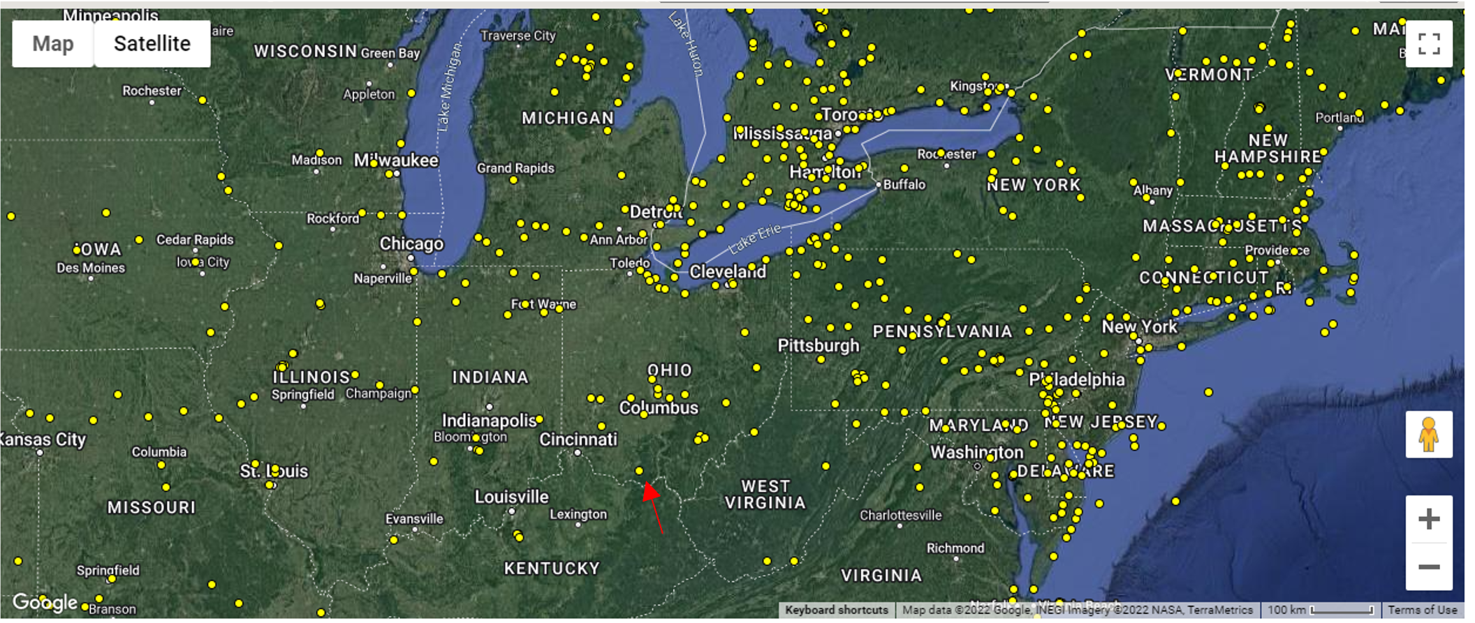
Current Motus tower network in our region. Motus tower locations are yellow dots. The EOA tower is indicated by the red arrow.
In September, the Edge of Appalachia Preserve System (EOA) joined the Motus network when we erected a new receiver tower on the property. This is the first tower to be operational in our region, helping to fill a huge gap in detection coverage in southern Ohio. The installation of this tower was a joint effort between Cincinnati Museum Center, The Nature Conservancy, Ohio University, and many others. This tower can record data from any animal tag emitting compatible frequency signals moving through our area. In addition to assisting other researchers on their projects by being part of the Motus network, next summer we plan to place radio telemetry tags on some of the birds using EOA land to better understand how these species use our preserve and move across the landscape. Our target species are Henslow’s Sparrow (Centronyx henslowii), a grassland bird, and the American Kestrel (Falco sparverius), North America’s smallest falcon species.
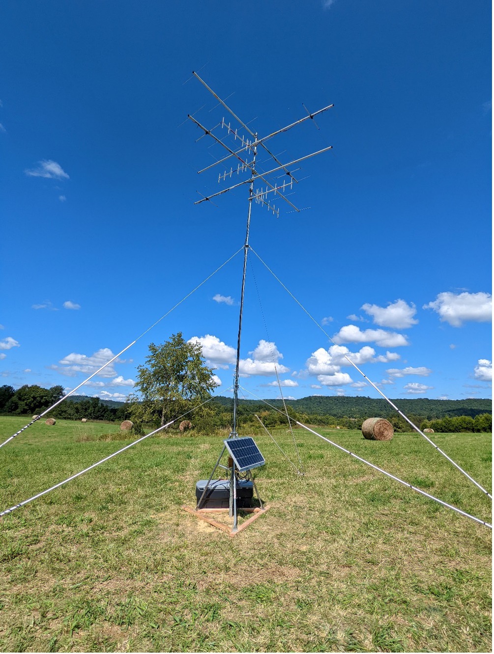
Picture of our EOA tower installation. Photo courtesy of Michael Hall.
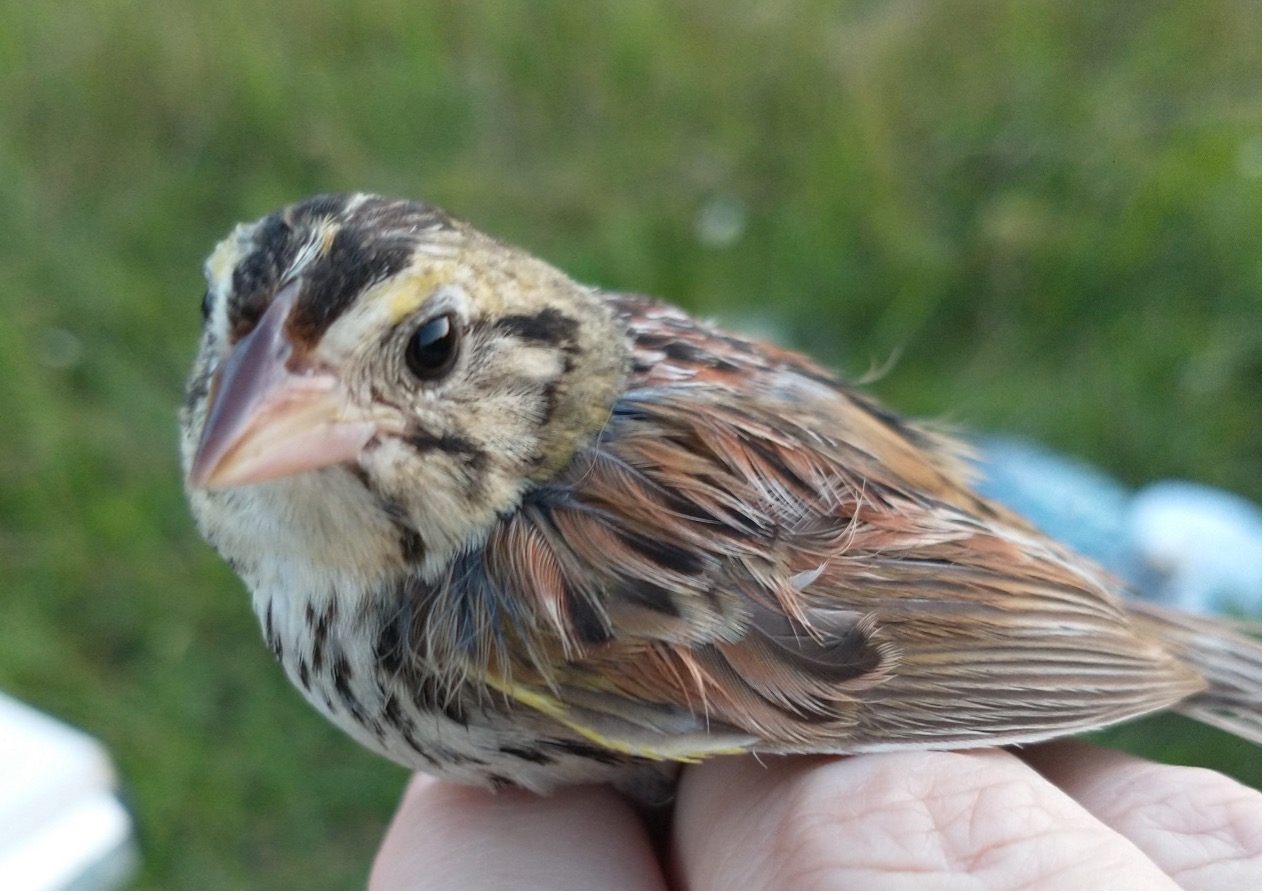
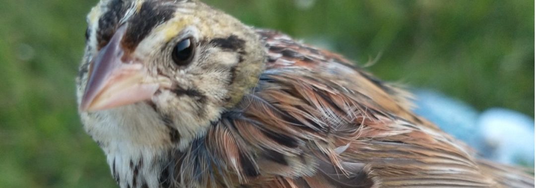
Henslow’s Sparrow banded at EOA in July 2021 as part of our ongoing grassland bird species surveys.
If you would like to read more about the Motus network and the studies it is supporting, check out their website at https://motus.org/.