
X Marks the Spot: Knowing Where we are in Archaeology Field Work
By: Bob Genheimer, George Rieveschl Curator of Archaeology
Do you always know where you are? Well, when we are digging in the field, I can usually tell you to within a centimeter or two. Why is this important? It is because the “control” of space allows us to more adequately reconstruct what is going on at a site. Most sites have areas of greater concentration and lesser concentration of artifacts, and in the case of a village site, it may be structured to include areas of houses, trash pits or communal space. Knowing where these things are and how they relate to each other is very important.
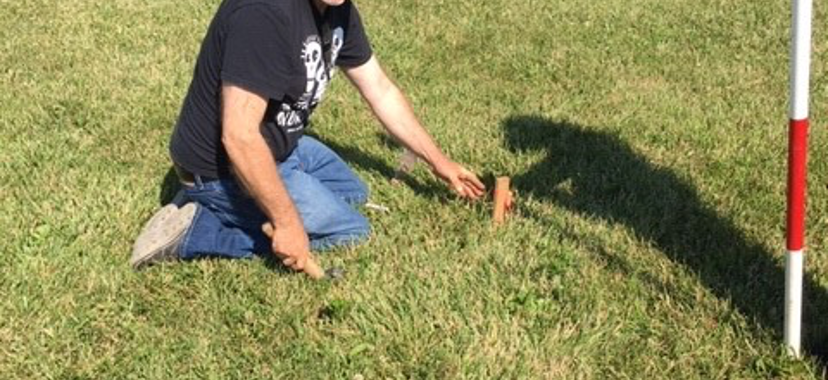
But how do we achieve such fine-grained control of space? It all starts with setting up known points on the ground. This point, or points, is referred to as a datum, or datums (that’s right, the plural of datum can be datums). A datum is an actual permanent stake, often set in concrete, which can be accessed year after year. At the Hahn site, our annual field school location in Anderson Township, we placed two datums that form the main north axis for the site. Once the datums are in place, then a virtual grid system can be imposed over the site.
Nodes on the grid system can be accessed through the use of a total station system. The total station is an electronic surveying transit that utilizes electronic distance measurement (EDM). You’ve all seen these transits at construction sites, often with a second person carrying a rod with a prism reflector. The transit utilizes an infrared carrier signal that is returned by the prism reflector back to the transit. In simple terms, if the transit can see the prism reflector, it can ascertain its coordinates. This is how a grid system can be imposed on the ground.
Once you have a grid system, excavation units (digging blocks) can be placed on the ground in reference to the grid. Typically, each of the four corners of the unit is marked with a wooden stake. Any precise locations within the units can be obtained by measuring to one of these stakes. So, when we dig a trash-filled storage pit at the Hahn site, we know the location of the pit because it is mapped within the unit. And, we know where the unit is because it is tied to the site grid system.
We also track vertical control, in other words, how deep things are. While we rarely encounter general cultural debris greater than 50 cm (20”) below ground surface, within pit features, we sometimes dig to as much as 2 or more meters (6.5’) below surface. Knowing how deep items are within a pit can tell us the time frame for filling of the feature.
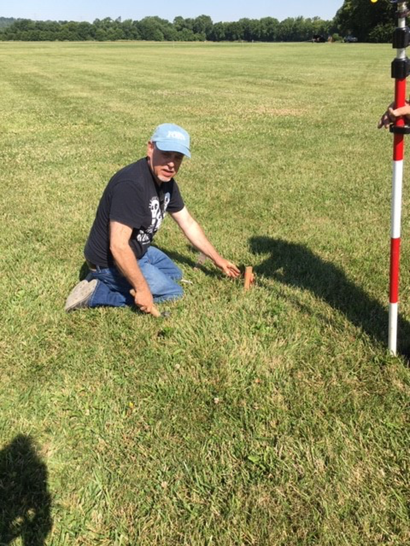
Bob Genheimer places a datum at the Hahn Site.

Archaeological features at the Hahn Site identified by remote sensing.