
Seeing Beneath the Ground: Remote Sensing at the Hahn Site
By: Bob Genheimer, George Rieveschl Curator of Archaeology
You may wonder how Cincinnati Museum Center’s archaeologists decide where to dig when we excavate a site. In part, our decisions are based on which questions we are trying to answer (e.g. what did they eat, how did they cook, what were their houses like, etc.), and on how much we can accomplish within a short amount of time. But, to answer most of these questions, it is helpful to know with some accuracy what lies beneath the surface. For this, we turn to ground-based remote sensing, also known as archaeological geophysics.
Archaeological geophysics uses near or on-ground techniques to locate and create maps of archaeological deposits or features below the ground. These below ground features may be detectable when they contrast with what is surrounding them. Hence, a large trash-filled storage pit may become “visible” simply because its contents are much different than the surrounding soil. In historical archaeology, the same is true for a buried stone wall – it may be visible in remote sensing because it contrasts with its non-stone surroundings.
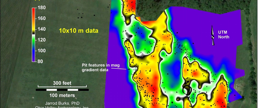
At the Hahn site, Cincinnati Museum Center’s field school location in Anderson Township, Ohio, three types of remote sensing have been utilized. The first is magnetic susceptibility. This technique measures the ability of the upper layer of soil to be magnetized. The presence of village waste and burned debris may increase susceptibility readings (Figure 1). The second is ground-penetrating radar, or GPR. In this technique, a radar pulse is directed into the ground. Subsurface objects, and even differences in soil layers, may cause reflections that identify the location and depths of these features. Third is magnetometry. Magnetometry measures slight differences or disruptions in the earth’s magnetic field and is applied by walking a detector over the surface of the ground. It is magnetometry that became the workhorse technique at the Hahn site.
Let’s take a quick look at the broad magnetometry survey conducted at the Hahn Site by Dr. Jarrod Burks of Ohio Valley Archaeology Inc. Initial work at Hahn began with a type of handheld magnetometer called a gradiometer. Later, two separate versions utilizing carts with multiple gradiometers were used. The most recent cart utilized a GNSS (global navigation satellite system) receiver tied to a nearby GNSS station that enable the precise location of the cart to be known at any time (Figure 2).
In general, the Hahn magnetometry map (Figure 3) shows a central area of low readings typical of a central plaza and hundreds of dot-like anomalies surrounding the plaza that most likely represent pit features. Since we know the precise location of the anomalies, we can place an excavation unit around any one of them. Other items of interest include an earlier Hopewell-age (ca. 1-400 CE) circular earthwork and a lightning strike!
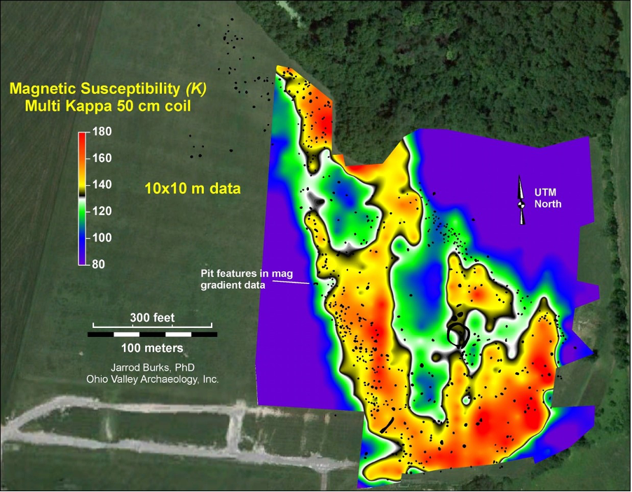
Magnetic susceptibility map of Hahn showing the variable ability of the soil to become magnetized. Note the central plaza (“cool” area in center) and another potential plaza to the north. Courtesy of Dr. Jarrod Burks, Ohio Valley Archaeology, Inc.
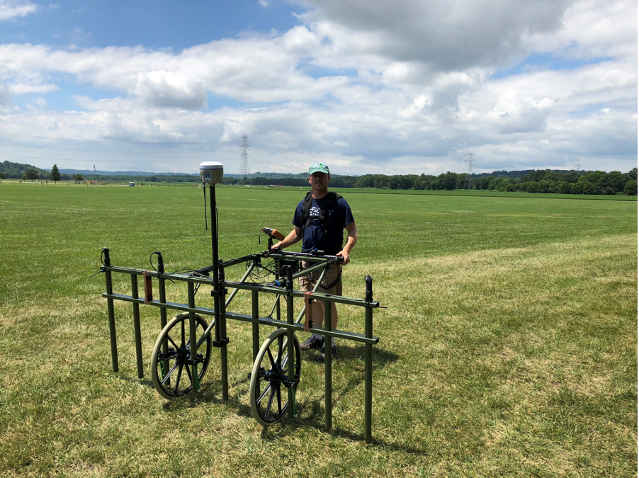
Jarrod Burks at Hahn with a magnetometry cart with five gradiometers and a GNSS receiver.
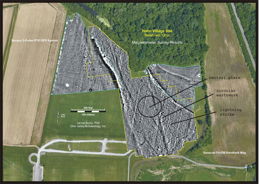
Most recent magnetometry map of Hahn showing feature anomalies, central plaza, circular earthwork and lightning strike. Courtesy of Dr. Jarrod Burks, Ohio Valley Archaeology, Inc.